Bernese Oberland
Alpine peaks and pristine lakes define mountain paradise
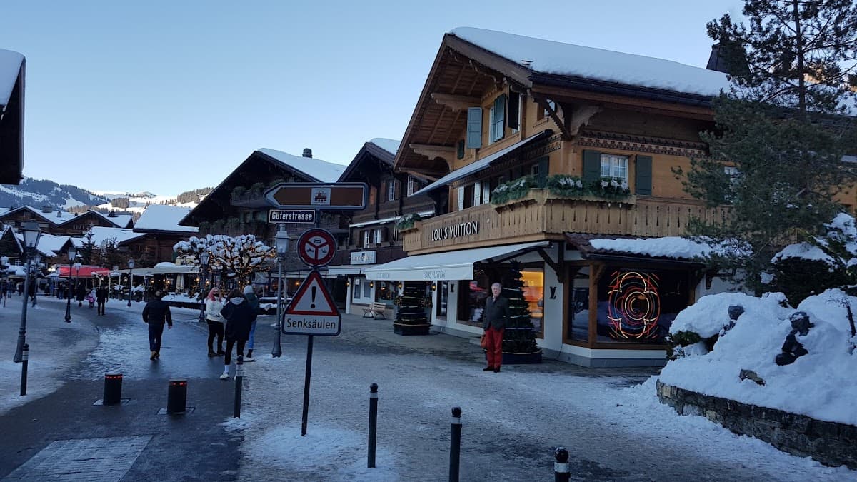
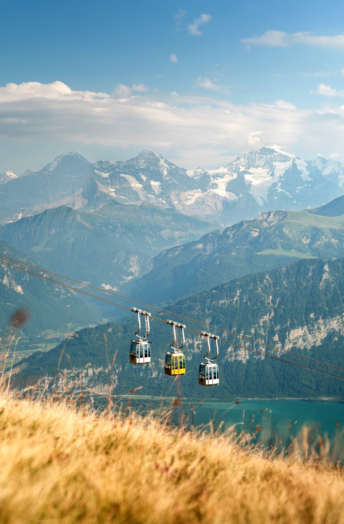
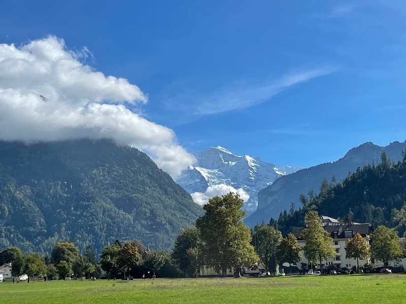
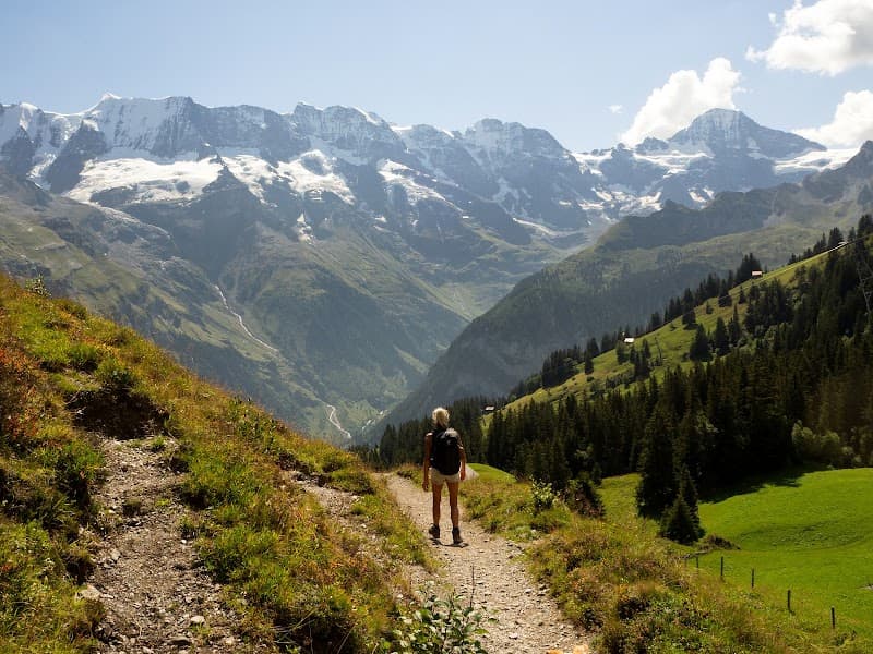
The Bernese Oberland isn't just another Swiss region — it's the Switzerland you see on postcards made real. Here, the Eiger's north face looms over emerald valleys while Lake Thun reflects snow-capped peaks like a mirror. You'll find yourself riding cogwheel trains to 11,000-foot viewpoints one day and sipping wine by a lakeside terrace the next. This is where adventure seekers come to paraglide off the Schilthorn, families discover their kids can actually hike without complaining, and couples realize why Switzerland invented the honeymoon suite. But here's the thing: it's expensive, the weather can be moody, and those Instagram-famous spots get crowded. Still worth it? Absolutely.
Culture & Context
BERNESE DIALECT DEFINES IDENTITY
The Bernese Oberland speaks Bärndütsch — Bernese German — a dialect of High Alemannic Swiss German that even native German speakers from Germany find extremely difficult to understand. Don't be embarrassed if it sounds like a foreign language. Locals know this and will switch to standard German or English with foreigners immediately.
Swiss German is not just an accent — it's a core piece of cultural identity. The Bernese canton parliament conducts its debates in Bärndütsch. It's used in offices, restaurants, and theaters. The dialect carries real local pride and is not considered 'informal' the way regional dialects sometimes are elsewhere.
The region has over 3,000 farms. Agriculture — particularly dairy — is not background scenery, it's an active industry. Those bells you hear across the valley? Real cows, real work. Alpine cheese dairies (Alpkäsereien) welcome visitors and a tasting platter with local cheese and regional wine costs around CHF 25–40. Worth every franc.
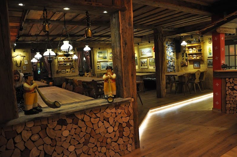
Yodeling and alpine brass bands are not tourist theater. Traditional herdsmen's songs (Kuhreihen) have roots going back centuries in the Bernese Oberland. The Menuhin Festival deliberately pairs world-class classical music with this landscape precisely because the region has always been defined by its musical traditions.
Sustainability is increasingly woven into local tourism culture. In 2026, the region has expanded Green Travel initiatives encouraging public transport. Visitors who mention environmental concerns will find a receptive audience — Swiss mountain communities are acutely aware of glacier retreat and changing snow patterns. Several trails now have interpretive signs about climate impact on alpine ecosystems.
Local Customs
GRÜEZI ON EVERY TRAIL
Punctuality is not optional — it's a cultural value. Trains run to the second. If you're meeting someone or catching a mountain transport connection, be early..
Sundays are quiet. Shops close, most supermarkets are shut, and noise should be kept down in residential areas. Plan grocery runs for Saturday..
Tipping is not required or expected the way it is in North America. Service and tax are included in all Swiss restaurant bills. Leaving 1–5 CHF extra if the service was genuinely good is appreciated but not obligatory..
Hiking trail etiquette: greet everyone you pass on the trail with Grüezi. Every single person. It's not weird — it's the Swiss Alps and you are required to be friendly on mountains..
The cattle processions (Alpaufzug / Almaufzug) happen in spring and autumn as cows move to and from high alpine pastures. In villages like Engstligenalp, these are genuine local events, not staged photo ops. Cows wear massive decorated bells.
Step aside and let them pass.. Swiss German is the spoken language, but you will not be understood if you speak standard German with a foreign accent — locals will switch to English immediately. Just start in English and let them lead..
Tap water is safe and excellent everywhere in Switzerland — even from mountain fountains. Asking for 'Hahnenwasser' (tap water) at a restaurant is perfectly acceptable and will save you CHF 4 per glass.. Environmental norms are strict.
Stay on marked trails, do not pick wildflowers (many protected), take all rubbish with you. In 2026 the region has expanded Green Travel initiatives encouraging public transport over rental cars.. Many small mountain villages have car restrictions or are entirely car-free (Mürren, Wengen, Gimmelwald).
Driving in means paying for parking and then switching to trains and cable cars anyway — return the rental car before heading into the Jungfrau region.. Altitude at Jungfraujoch reaches 3,571m. Some visitors experience headaches or nausea.
Go slowly, stay hydrated, and skip the summit if you feel unwell. There is no shame in turning back — Swiss mountain safety culture is pragmatic, not macho.
Safety
WEATHER & ALTITUDE DEMAND RESPECT
Switzerland consistently ranks among the safest countries in the world for travelers. Crime against tourists is extremely rare. That said, the mountains have their own set of risks to take seriously.
Altitude: Jungfraujoch sits at 3,571m. Some visitors experience headaches, nausea, or fatigue. Go slowly on arrival, stay hydrated, eat lightly. People with heart conditions or respiratory issues (including asthma) should consult a doctor before visiting high-altitude stations.
Weather changes fast. The valley floor can be 25°C while the summit has snow and freezing winds simultaneously. Always carry a windproof layer, waterproof jacket, and warm mid-layer regardless of the season. Pack this in your daypack on every hike — not just when it looks cloudy.
Thunderstorms are common in summer, especially afternoons. If you're on an exposed trail or ridge, descend. Check the MeteoSwiss app before every alpine day. Mountain hut staff and tourist offices can give current assessments — ask them.
Hypothermia is a real summer risk when wet and at altitude. Avoid cotton clothing on hikes — it takes too long to dry. Use rain gear as soon as it starts raining, not after you're already soaked.
Trail conditions vary by season. Early season (May–June) can have significant snow on high routes. The Hiking Club's Bernese Oberland Trail Updates page tracks 2026 snow conditions in real time, particularly for multi-day traverses. Check it before setting out on anything above 2,000m.
Sunburn is underestimated at altitude — UV intensity increases roughly 10% per 1,000m. Apply SPF 50+ generously, even on overcast days, and protect lips and eyes.
The most common injury evacuated from alpine trails is an ankle injury — watch your footing on descent, especially on loose rock or wet surfaces. Proper footwear matters more than any other gear decision.
Emergency number: 117 (police), 144 (ambulance), 1414 (Rega mountain rescue). Mountain rescue in Switzerland is excellent but can be expensive without travel insurance — get cover that includes helicopter evacuation.
Getting Around
TRAINS BEAT RENTAL CARS
The Bernese Oberland's public transport network is one of the best arguments for never renting a car in Switzerland. Trains, PostBuses, boats, cable cars, and cogwheel railways connect almost everywhere — including places cars literally cannot go. Mürren, Wengen, and Gimmelwald are fully car-free.
From Zurich: direct train to Interlaken Ost (~2 hrs). From Geneva: ~3 hrs. From Bern: ~1 hr. From Lucerne: Luzern-Interlaken Express (covered by Berner Oberland Pass and Swiss Travel Pass).
The Berner Oberland Pass (CHF 240 for 3 days, up to CHF 435 for 10 days in 2026) covers trains, PostBuses, boats on Lakes Thun and Brienz, and most cable cars free or discounted. It's valid year-round as of 2024. Buy it online via the official SBB tourist webshop (swissrailways.com) to get a QR code — paper tickets bought at stations lack this. The pass covers Bern, Interlaken, Grindelwald, Wengen, Gstaad, Mürren, Lauterbrunnen, Kandersteg, and even the train to Lucerne.
For Jungfraujoch specifically, the Berner Oberland Pass gives a 25% discount (not free). The Jungfrau Travel Pass covers just the Jungfrau Region and may be better value if you're staying only in that sub-area.
Use the SBB Mobile app for real-time timetables, mountain lift schedules, and weather updates. It's essential in 2026 — mountain transports can be suspended with little notice due to weather.
If you insist on driving: park at Stechelberg (1,500 spaces) for Mürren access, or Grindelwald Grund (300 spaces) for the Grindelwald area. Lots fill by 10 AM in July and August. Honestly — return the car at Interlaken and take trains from there. You will not regret it.
Useful Phrases
Explore Cities
Explore the Region
Bernese Oberland Itineraries

Money-Saving Tips
- 1.Buy groceries at Coop or Migros instead of eating every meal out — restaurant prices average 30-50 CHF per person
- 2.The Swiss Half Fare Card pays for itself if you're taking more than one mountain railway — saves 50% on most lifts
- 3.Stay in Interlaken or Thun instead of mountain villages to cut accommodation costs by 30-40%
- 4.Pack your own lunch for hiking — mountain hut meals cost 15-25 CHF for basic dishes
- 5.Visit in shoulder seasons (June or September) when hotels drop prices but most attractions stay open
- 6.Take the postal bus to remote valleys — it's included with the Swiss Travel Pass and offers great scenery
- 7.Book mountain railway tickets online in advance for small discounts, especially for Jungfraujoch
- 8.Consider apartment rentals for stays longer than 3 nights — many include kitchen facilities to save on dining
Travel Tips
- •Download the SBB app for real-time train schedules and platform changes — Swiss trains run like clockwork but connections matter
- •Check mountain weather at MeteoSwiss before heading up — conditions can change from sunny to snowy in hours
- •Bring layers even in summer — it's 20°F cooler at 10,000 feet than in the valleys
- •Book popular mountain railways like Jungfraujoch early in the day — afternoon clouds often block views
- •Learn basic German phrases — English works in tourist areas but locals appreciate the effort
- •Carry cash — many mountain huts and small restaurants don't accept cards
- •Start hiking early to avoid afternoon thunderstorms and secure parking spots
- •Respect hiking trail closures — Swiss authorities close dangerous routes for good reasons
- •Try local public transport apps like PostAuto for bus schedules to remote valleys
- •Pack sunglasses and sunscreen — UV rays intensify at altitude even on cloudy days
Frequently Asked Questions
BUILD YOUR
BERNESE OBERLAND PLAN
Insider picks, smart timing, and a plan ready when you are.
Start Planning