SUBREGION GUIDE
Routeburn Track
New Zealand's premier alpine hiking experience through pristine wilderness
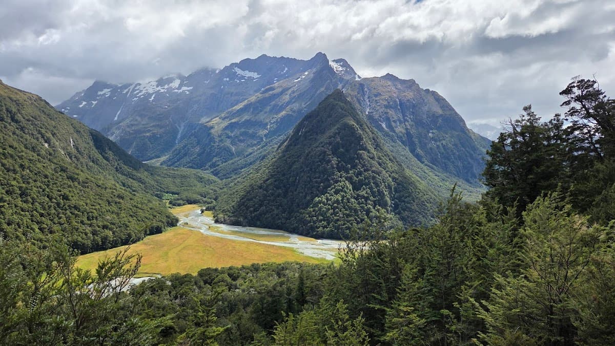
The Routeburn Track cuts through some of New Zealand's most jaw-dropping alpine scenery. This 32-kilometer trail connects Mount Aspiring and Fiordland National Parks, threading between snow-capped peaks, emerald lakes, and ancient beech forests. But here's the thing - it's not your typical weekend hike. The track demands advance planning, proper gear, and a decent fitness level. Most hikers tackle it over 2-3 days, staying in DOC huts along the way. The reward? Views that'll make your Instagram followers weep with envy and memories that stick around long after your boots are back in storage.
The Routeburn Track officially starts at either Routeburn Shelter (Glenorchy end) or The Divide (Te Anau end). Most people begin from Glenorchy because the initial climb gets your heart pumping right away - no gentle warm-up here. Day one takes you 8.5 kilometers to Routeburn Flats Hut, gaining about 300 meters in elevation through red beech forest. The real magic happens on day two: the climb to Harris Saddle at 1,255 meters. This section separates the weekend warriors from the serious hikers. The payoff is Conical Hill - a short side trip that delivers 360-degree views of the Hollyford Valley and Darran Mountains. From Harris Saddle, it's mostly downhill through the Hollyford Valley to Mackenzie Hut. Day three covers the final stretch to The Divide, passing Lake Howden and the Earland Falls along the way. Pro tip: if you're feeling ambitious, tackle it in two days instead of three. Just know that day one becomes a proper slog.
Money-Saving Tips
- 1.Book hut passes in advance during peak season - they're significantly cheaper than paying the warden on-site
- 2.Pack all your own food from supermarkets in Queenstown or Te Anau rather than buying expensive trail food at outdoor stores
- 3.Share shuttle transport costs by coordinating with other hikers on Facebook groups or hostel notice boards
- 4.Visit during shoulder seasons (October, March-April) for the same experience at lower accommodation and transport costs
- 5.Rent gear in Queenstown if you're missing items - buying new outdoor equipment in New Zealand is expensive
- 6.Consider the winter ticket system (May-September) at $15 per night if you have alpine experience and proper gear
Travel Tips
- •Download offline maps to your phone - cell coverage is non-existent on most of the track
- •Pack extra food for at least one additional day in case weather delays your hike
- •Start early each morning to avoid afternoon weather changes and secure good spots in huts
- •Bring cash for hut fees if hiking outside peak season - wardens only accept cash payments
- •Check weather forecasts at DOC offices before starting - conditions can change rapidly in alpine areas
- •Break in new boots at least 2 weeks before hiking to avoid painful blisters
- •Carry water purification tablets even though hut water is generally safe to drink
- •Book return transport when you book your outbound shuttle to guarantee a ride back to town
Frequently Asked Questions
The Routeburn Track is considered moderately difficult. It requires good fitness for steep climbs, especially to Harris Saddle, and proper hiking experience. The track includes rocky sections, potential mud, and rapidly changing weather conditions.
BUILD YOUR
ROUTEBURN TRACK PLAN
Insider picks, smart timing, and a plan ready when you are.
Start Planning