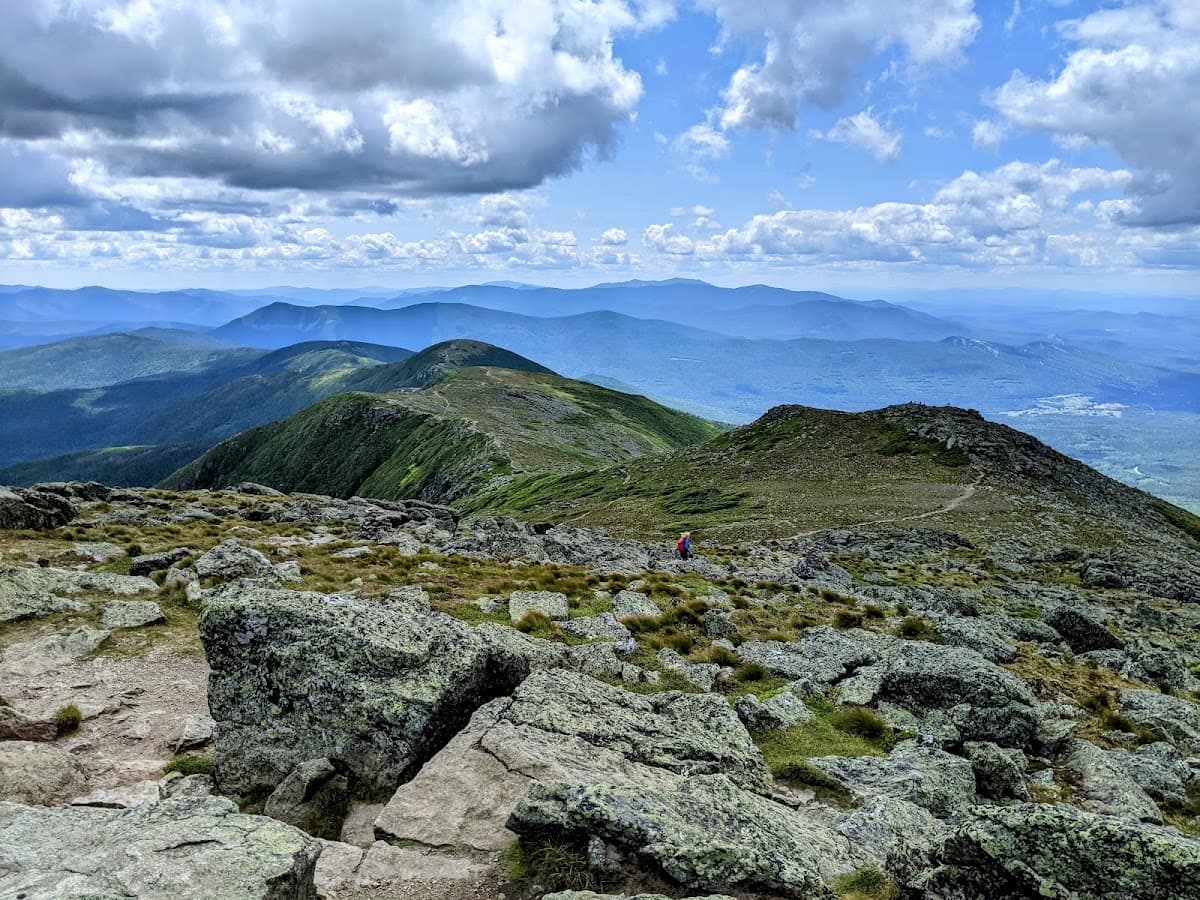
Mount Washington
Northeast's highest peak with notoriously unpredictable weather challenges
Mount Washington isn't your typical mountain getaway. At 6,288 feet, it's the Northeast's highest peak and home to some of the world's most extreme weather. The summit weather station recorded winds of 231 mph in 1934 — a world record that stood for decades. But here's what makes this place special: you can drive to the top via the Mount Washington Auto Road, take the historic Cog Railway, or earn your bragging rights hiking the challenging trails. The White Mountain National Forest surrounds the peak, offering everything from family-friendly nature walks to technical alpine routes. Just remember — the weather up there changes faster than your GPS can recalculate.
Best Months
JUN – OCT
~20°C · peak crowds
Culture & Context
EXTREME WEATHER OBSERVATORY
Mount Washington is called Agiocochook by some Native American tribes and has been a significant landmark for thousands of years. The first recorded European ascent was in 1642. The Auto Road opened in 1861 as a carriage route — one of the oldest mountain toll roads in the country. The Cog Railway followed in 1869, the first mountain-climbing cog railway in the world, built by Sylvester Marsh after he nearly died in a storm on the summit.
The mountain sits in the Presidential Range, where most peaks are named after U.S. presidents. The surrounding White Mountain National Forest covers more than 800,000 acres of northern New Hampshire and western Maine.
The Mount Washington Observatory has operated a weather research station continuously on the summit since 1932. It's a private, nonprofit institution — not a government agency — sustained largely by members and visitors. The summit record of 231 mph wind was set on April 12, 1934, and held the world record for non-tornado winds for most of the 20th century.
New Hampshire's "Live Free or Die" identity is genuine, not performative. Locals are fiercely independent, resistant to outside interference, and skeptical of anyone telling them what to do — including tourists who show up underprepared on the mountain and require expensive rescues. NH Fish and Game issues pointed public statements after rescues of underprepared hikers, and locals generally agree with the sentiment. Come prepared or don't come.
Local Customs
CHECK FORECAST ALWAYS
Check the Mount Washington Observatory higher summits forecast before ANY hike above treeline. Text 'weather' or 'forecast' to 603-356-2137 for current conditions. This is not optional — it's the difference between a great day and an emergency..
The 'This Car Climbed Mount Washington' bumper sticker is earned by driving the Auto Road yourself. It's a real point of pride, and you'll see it on vehicles all over New England.. Book Cog Railway tickets well in advance.
Trains routinely sell out, especially on weekends and during foliage season. Walk-up seats are available but risky.. Download offline maps and a paper route description before hiking.
Cell service is genuinely unreliable above treeline, even on Verizon. Don't count on GPS to bail you out.. Dress in layers even in July.
Temperatures can be 70°F at the trailhead and snowing at the summit. It's not an exaggeration — it happens regularly.. New Hampshire has no state sales tax.
This is a very big deal locally, and shopping in North Conway at the tax-free outlets is considered a legitimate activity, not just tourist behavior.. The Appalachian Mountain Club (AMC) huts dot the Presidential Range. Reservations are required.
If you're planning a multi-day traverse, book months ahead — the AMC hut system fills up fast.. Never assume a calm morning at the base means the summit is fine. 'Conditions at the parking lot can differ greatly from the summit' is something NH Fish and Game says over and over, usually after a rescue.
Safety
DEADLY & UNPREDICTABLE
Mount Washington has claimed over 150 lives since recordkeeping began in 1849. The mountain holds the northern hemisphere record for highest non-tornado wind speed ever measured: 231 miles per hour. That's not marketing copy — it's a real hazard. The peak averages 25 rescues each year, and victims range from unprepared beginners to expert hikers with decades of experience.
Here's the core problem: you can wake up in Boston at 5am, drive two hours, and be on the trail by 9am. That accessibility lulls people into underestimating the mountain. Once you break treeline at around 4,500 feet, there is no shelter from the elements whatsoever. Weather can turn from pleasant to life-threatening in under an hour.
Practical safety rules: Always check the Mount Washington Observatory higher summits forecast (mountwashington.org) before hiking. Tell someone your exact route. Carry warm, waterproof layers even in summer. Bring a paper map — don't rely solely on GPS or cell signal above treeline. Know that 80% of mountaineering accidents happen on the descent, not the climb. If weather closes in, turn around. The mountain is not going anywhere.
Winter and spring skiing in Tuckerman Ravine and Huntington Ravine require avalanche education, crampons, and an ice axe. These are backcountry zones with unmitigated hazards. A 2024 fatality in Tuckerman Ravine led to the documentary "The Proving Ground" — worth watching before spring ski plans.
The Auto Road is closed during severe weather and opens weather-permitting. The Cog Railway will shorten trips or halt operations if summit winds exceed 60–70 mph. No refunds for weather closures on the Auto Road. Check daily road status before you drive out.
Getting Around
AUTO ROAD OR COG
There is no public transit to Mount Washington. A car is essentially required.
Auto Road (eastern approach): The entrance is off Route 16 at Pinkham Notch in Gorham, NH. Drive-yourself adult toll is $36, kids ages 4–12 pay $15, under 4 free. A guided 2-hour narrated van tour starts at $57 per adult. Guided tours run 9:00am to 3:45pm Memorial Day weekend through end of season, weather permitting. The road is 7.6 miles to the summit. A season pass costs $125 for adults and $45 for kids — worth it if you'll visit more than twice.
Important GPS warning: Many navigation apps still route drivers to the Cog Railway's base station (off Route 302 near Bretton Woods) instead of the Auto Road entrance at Pinkham Notch. These are on opposite sides of the mountain, 50+ miles apart by road. Double-check which side you're headed to before you leave.
Cog Railway (western approach): Base Station Road, 6 miles east of Route 302 near Bretton Woods. Round-trip adult tickets run approximately $89 during peak season. The Cog runs year-round, though the summit State Park facilities close mid-October through late May. In winter, trains terminate at Waumbek Station (around 3,800 feet elevation). Arrive at least 45 minutes before your scheduled departure.
Nearest major airports: Manchester-Boston Regional Airport (MHT) is roughly 2 hours south. Portland International Jetport (PWM) is about 1.5 hours east. Logan International (BOS) is 2.5 hours south but involves heavier traffic. Car rentals are available at all three.
Useful Phrases
Itineraries coming soon
We're working on adding amazing itineraries for Mount Washington. In the meantime, try the app to create your own!
Money-Saving Tips
- 1.The Mount Washington Auto Road offers a discount if you drive up and take the Cog Railway down (or vice versa) — ask about combo tickets
- 2.Pack your own food and drinks for summit visits — the cafeteria prices are steep and selection is limited
- 3.Stay in North Conway instead of the Mount Washington Resort to save $200+ per night while still being close to activities
- 4.Visit during weekdays in September for lower accommodation rates and thinner crowds on trails
- 5.Buy an America the Beautiful Annual Pass ($80) if you plan to visit other national forests or parks — it pays for itself quickly
- 6.Check Groupon for discounted Cog Railway tickets, especially during shoulder seasons
- 7.Camping at White Mountain National Forest campgrounds costs $25-30 per night versus $150+ for hotels
Travel Tips
- •Always check weather conditions before heading up — the summit can have snow even when it's 80°F at the base
- •Bring layers including winter gear even in summer — temperatures can drop 40+ degrees from base to summit
- •Download offline maps before you go — cell service is unreliable throughout the White Mountains
- •Start early if hiking — afternoon thunderstorms are common and dangerous above treeline
- •The Auto Road is one-way up until 10 AM and one-way down after 5 PM on busy days to manage traffic
- •Carry extra water and snacks — altitude and exertion dehydrate you faster than you think
- •Tell someone your hiking plans and expected return time — search and rescue operations happen regularly here
- •Break in hiking boots before your trip — the rocky terrain is unforgiving on new footwear
- •Book Cog Railway tickets in advance during peak foliage season (late September/early October)
Frequently Asked Questions
Explore Mount Washington
BUILD YOUR MOUNT WASHINGTON PLAN
Insider picks, smart timing, and a plan ready when you are.