Moab
Utah's red rock adventure capital and outdoor playground
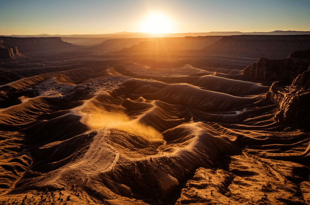
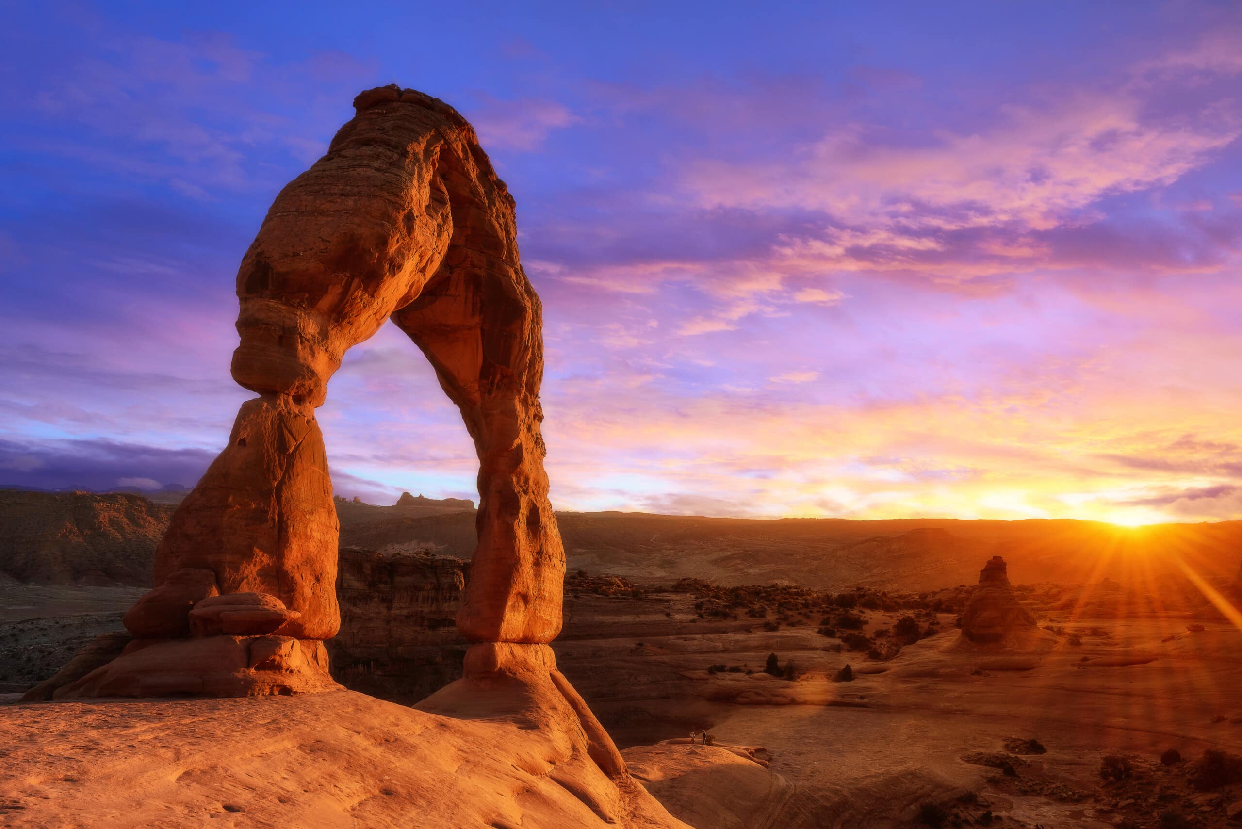
Look, Moab isn't trying to be anything other than what it is: a dusty desert town surrounded by some of the most jaw-dropping red rock formations on the planet. This is where mountain bikers come to test their limits on the Slickrock Trail, where hikers chase Instagram-worthy shots at Delicate Arch, and where the night sky puts on a show that'll make you forget your phone exists. Sure, it gets crowded during peak season. But there's a reason people keep coming back to this corner of southeastern Utah.
Best Months
MAR · APR · MAY · SEP · OCT · NOV
~23°C · high crowds
Culture & Context
TOURISM VERSUS LOCALS
Moab is a tiny town of about 5,400 people that somehow absorbs millions of visitors a year. That tension is real and visible. The local workforce is genuinely struggling with housing costs driven up by tourism and remote workers who discovered the views.
You'll see service industry staff commuting from 30+ miles out. LDS (Mormon) culture shapes things quietly — alcohol is available but don't expect a raucous bar scene, and Sunday mornings feel slower than in most tourist towns. The outdoor community here is intensely knowledgeable and takes stewardship of the land seriously.
Don't pick up rocks, don't walk off trail onto cryptobiotic soil crust (the dark, bumpy ground cover), and don't even think about touching petroglyphs. Locals can spot someone messing with the landscape from a hundred yards. And look, the red rock genuinely is as dramatic as advertised — but the best stuff often requires real effort, heat tolerance, and water.
This is not a casual stroll destination.
Local Customs
OFFLINE MAPS ESSENTIAL
Download offline maps before you leave town — cell service drops to zero fast once you head into the canyons or onto backcountry roads. Relying on Google Maps out there is how rescue calls happen.. At trailheads, stash your bags in the trunk or take them with you.
Smash-and-grab thefts are the most common crime tourists encounter. Police specifically warn visitors about this.. The cryptobiotic soil crust — the dark, lumpy ground cover — is a living organism that takes decades to recover if crushed.
Stay on rock or established trails at all times, even when it means a longer walk.. Human waste is a serious problem in popular dispersed camping areas, especially in Canyonlands backcountry. Bring a WAG bag (waste containment bag) and pack out everything.
You can buy them at the Moab Information Center downtown.. Go early or go late. Arches National Park now requires timed entry reservations from April through October.
Midday sun in summer means 100°F+ temperatures with no shade on most trails.. The free Moab Area Transit (MAT) shuttle runs 11am to 9pm daily from mid-March through mid-October. Use it.
Parking in town and at popular trailheads is a genuine headache in peak season.
Safety
HEAT & FLASH FLOODS
Here's the honest picture: crime statistics in Moab look alarming on paper, but context matters. The town has about 5,400 residents and absorbs millions of visitors a year. Most crime is property-related — smash-and-grabs at trailhead parking lots are the real tourist risk.
Police specifically tell visitors to hide backpacks in the trunk before hiking. Do it. Violent crime is inflated by tourist-volume distortion in the per-capita math, and roughly half involves people who know each other.
The bigger safety concern is the outdoors itself. Summer temperatures regularly hit 100°F+ with almost no shade on exposed trails. Flash floods can fill canyon washes with no warning — check the forecast before any canyon hike.
Cell service is solid in town but drops sharply once you head into the parks or backcountry. Don't solo hike remote trails without someone knowing your route and return time. Groups of three are ideal in the backcountry.
And don't attempt anything beyond your actual skill level — Moab has Jeep roads and bike trails that will genuinely wreck your vehicle or put you in the hospital if you misjudge your experience level.
Getting Around
RENTAL CAR REQUIRED
You need a car. Full stop. There is no meaningful public transit connecting Moab to anywhere else, and most of what makes the area worth visiting is not walkable from downtown.
The free Moab Area Transit (MAT) runs comfortable 12-passenger vans on a fixed Main Street route daily from 11am to 9pm, plus on-demand microtransit from 8am to 9pm, all from mid-March through mid-October. Download the MAT app to track vans and schedule pickups. For getting to town in the first place: Canyonlands Regional Airport (CNY) is 20 minutes north on US-191 and connects to Denver and Salt Lake City.
Salt Lake City is a 4-hour drive via I-15 south to I-70 east then US-191. Grand Junction, Colorado is just 1.5 hours away and is the closest city with a real airport.
Salt Lake Express runs shuttle service from SLC; Moab Express covers Grand Junction. Once you're here, a standard rental car handles Main Street and paved park roads. For backcountry — Jeep trails, Canyonlands Maze, White Rim Road — you want a high-clearance 4WD.
Rentals are available in town. Bike shuttle services like Hazard County Shuttle cover trailheads including Porcupine Rim and Whole Enchilada for mountain bikers.
Useful Phrases
Moab Itineraries

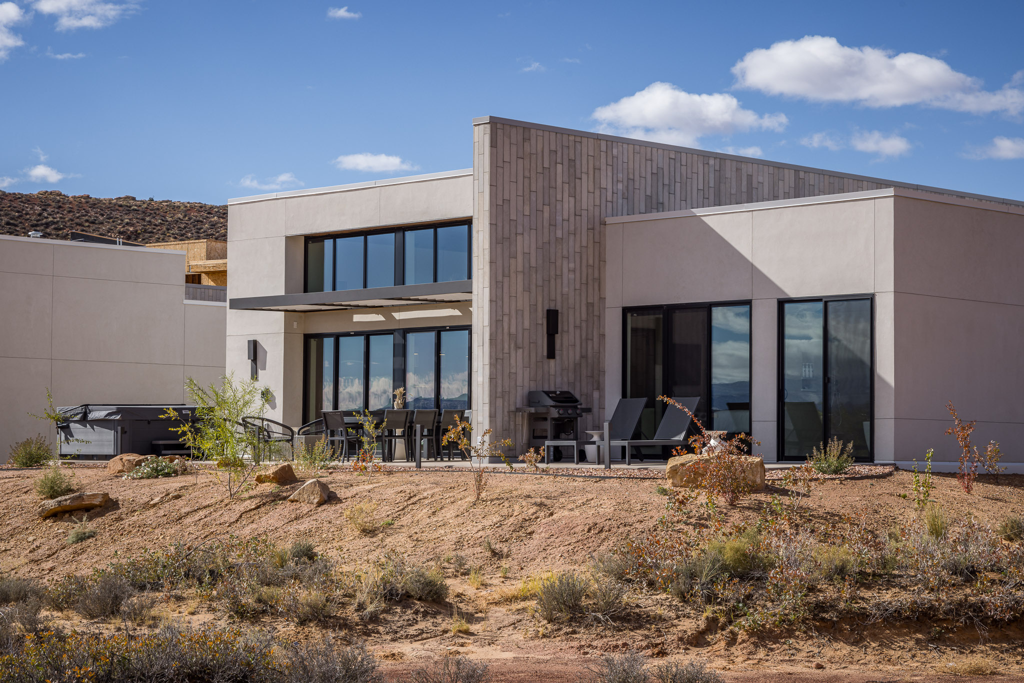
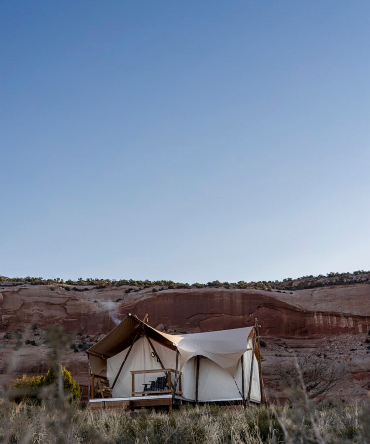
Where to Stay in Moab
3 recommended properties
Things to Do in Moab
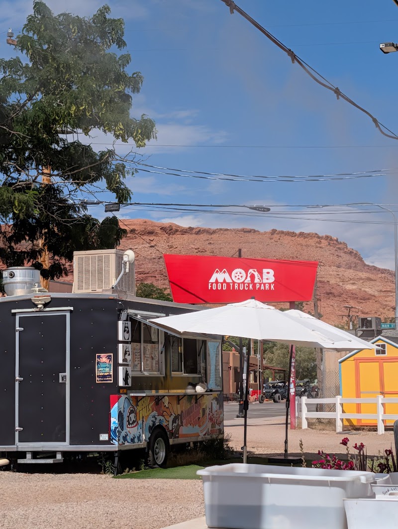
Moab Food Truck Park
Downtown Moab · 75 min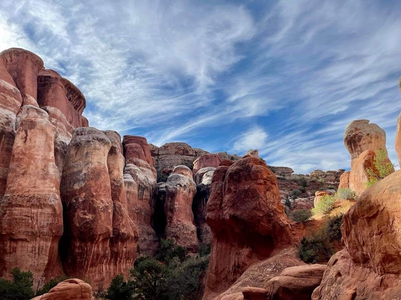
Fiery Furnace View Area
Arches National Park · 120 min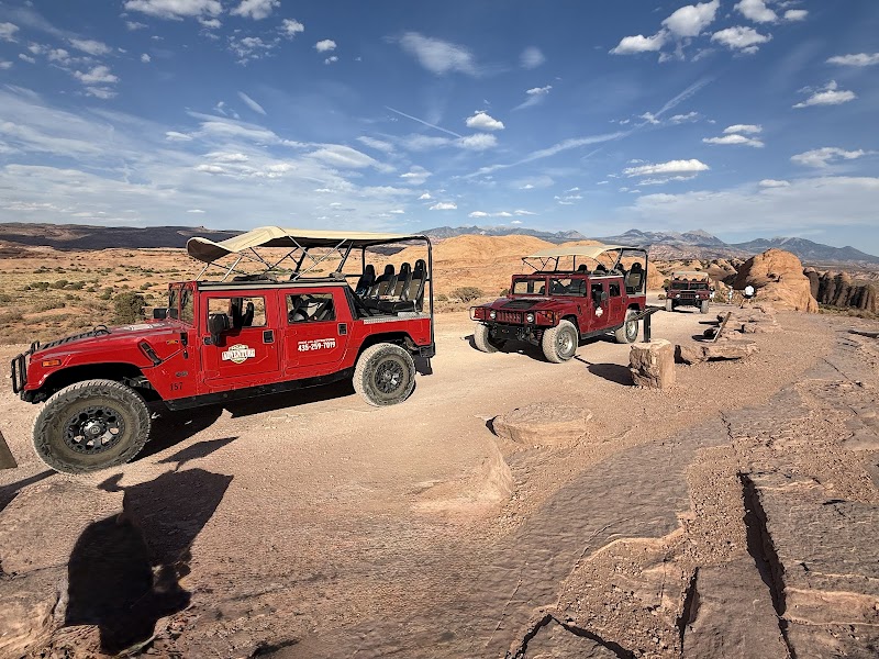
Moab Adventure Center
Downtown Moab · 45 minMoney-Saving Tips
- 1.Buy the America the Beautiful annual pass ($80) if you're visiting multiple national parks – it pays for itself after 3 visits
- 2.Camp at BLM sites outside town for free – many offer pit toilets and fire rings without the $30+ campground fees
- 3.Shop for groceries at City Market before heading to the parks – a sandwich costs $15 at visitor centers
- 4.Fill up your water bottles at the Moab Information Center downtown instead of buying $3 bottles at trailheads
- 5.Book accommodations 3-6 months ahead for spring and fall – last-minute rates can hit $300+ per night
Travel Tips
- •Start popular hikes like Delicate Arch by 7 AM to avoid crowds and afternoon heat
- •Carry more water than you think you need – the desert climate dehydrates you faster than expected
- •Download offline maps before heading out – cell service disappears quickly outside town
- •Wear closed-toe shoes with good grip – the slickrock is more slippery than it looks
- •Check weather conditions before attempting any slot canyon hikes – flash floods happen with little warning
- •Bring a headlamp even for day hikes – some trails require scrambling through dark sections
- •Respect cryptobiotic soil crusts – those black patches take decades to form and minutes to destroy