Grand Canyon
Nature's most spectacular geological masterpiece awaits your wonder
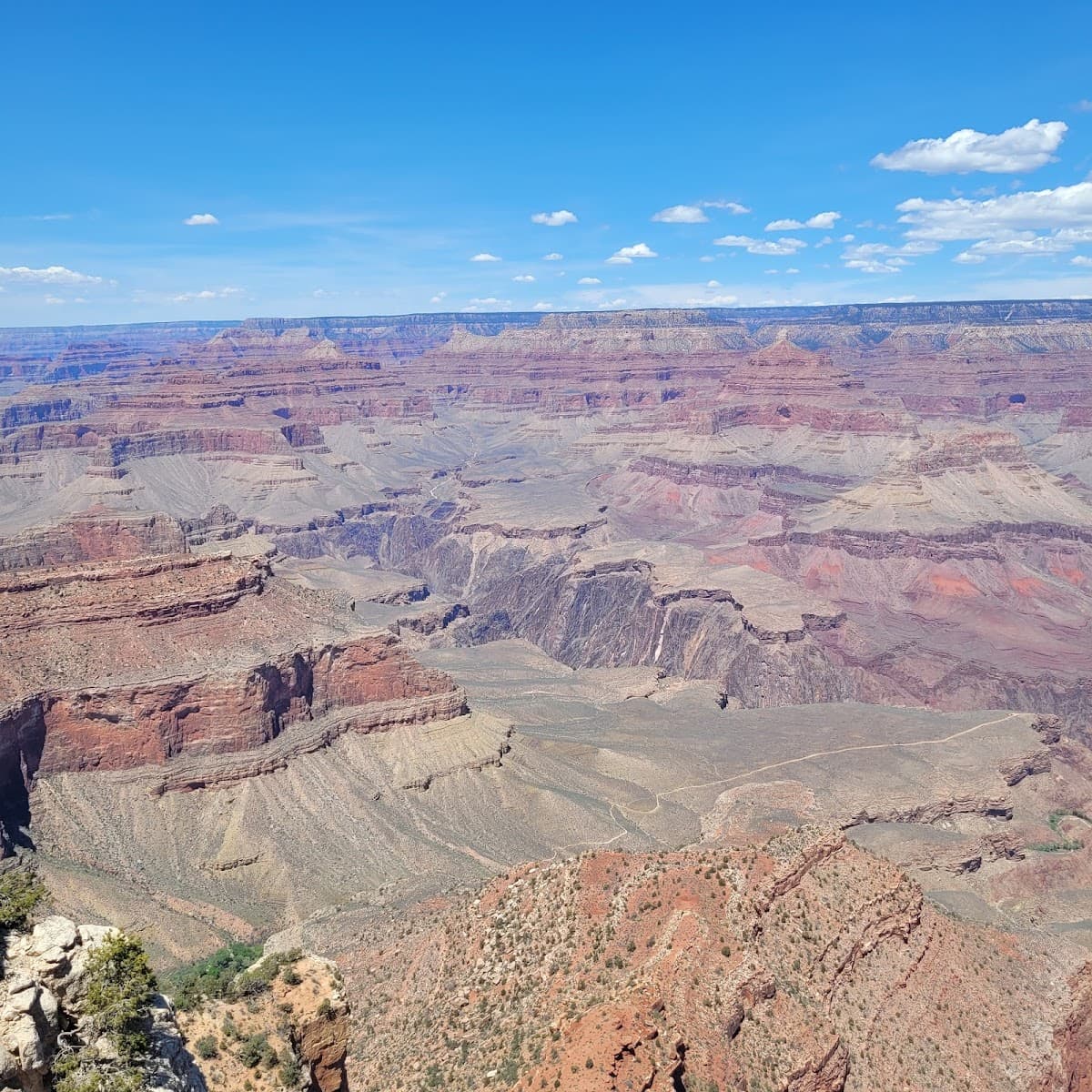
The Grand Canyon doesn't mess around. One look over the rim and you'll understand why 6 million people make the pilgrimage here every year. This isn't just a big hole in the ground—it's a 277-river-mile gash carved by the Colorado River over millions of years, revealing rock layers that tell Earth's story better than any textbook.
But here's what most visitors don't expect: the Grand Canyon has personality. The South Rim serves up classic postcard views with all the amenities. The North Rim? That's where you go for solitude and cooler temperatures. And the canyon floor? It's a completely different world down there, with its own weather patterns and ecosystems.
Look, this place can be overwhelming. The sheer scale breaks your brain a little. That's normal. Take your time. Find a quiet spot along the rim trail. Let it sink in. Because once you've stood on the edge of this geological masterpiece, every other vista feels a little smaller.
Best Months
APR · MAY · SEP · OCT
~21°C · high crowds
Culture & Context
SACRED TRIBAL HOMELANDS
The Grand Canyon is not just a geological curiosity. Eleven federally recognized tribes have formal ties to the canyon, and their connection stretches back at least 13,000 years. The Havasupai, whose name means "people of the blue-green waters," still live in Havasu Canyon, a side canyon only reachable on foot, by mule, or by helicopter. The Hopi consider the canyon a place of emergence in their origin story. The Navajo Nation's sprawling reservation borders the eastern park boundary. The Hualapai manage the West Rim, including the Skywalk, on their own tribal land entirely outside NPS jurisdiction.
Walk around the South Rim and you'll notice the canyon's workforce includes a significant number of Hopi, Navajo, and other tribal members. The canyon's place names tell the story too: Indian Garden (now Havasupai Gardens) along the Bright Angel Trail dates to ancient Havasupai use of the plateau. Hopi House, opened in 1905 across from El Tovar, was designed by Mary Colter and modeled on traditional terraced Hopi dwellings.
Here's the thing: the Fred Harvey Company and early tourism essentially turned Native American culture into a commodity. Today there's a real effort to reframe that. Support Native-owned artists and businesses when you can. When on or near Navajo lands, use the preferred term "Diné" rather than "Navajo." And understand that some areas you might find on a map are sacred and genuinely off-limits.
Local Customs
NEVER HIKE RIVER ROUNDTRIP
Don't hike to the river and back in one day. Rangers and experienced canyon veterans call this the single most dangerous thing visitors do. The descent is easy and deceptive — the brutal climb back up in afternoon heat is what sends people to the rescue teams.
Turn around when you've used one-third of your water.. Carry more water than you think you need. The NPS recommends 1 liter per hour of hiking.
And balance it with salty snacks — drinking water without electrolytes can cause hyponatremia, which has caused multiple deaths in the canyon.. Always ask permission before photographing Native American staff, performers, or cultural demonstrators. Many Hopi and Navajo employees work throughout the park and are gracious with curious visitors, but respect personal and cultural boundaries..
On Navajo lands adjacent to the park, drone photography is prohibited and professional photography often requires a permit. Dress modestly when visiting tribal lands — more conservative than typical outdoor tourist standards.. Do not remove rocks, artifacts, or any natural materials from the park.
This is federal law, not just etiquette. The canyon is sacred land to multiple tribes and every rock means something to someone.. Keep noise down, especially at viewpoints and on trails.
The canyon's acoustics carry sound surprisingly far. It's the kind of place where loud conversation actively ruins other people's experience.. Mule trains have right-of-way on all trails.
Step to the uphill side of the trail, stand still, and let them pass. Waving or sudden movements spook the animals.. Store all food and scented items in the provided hard-sided lockers or in your vehicle, not in tents.
The park has bold wildlife — elk, ravens, and squirrels have all figured out how to ruin an unsecured snack.
Safety
HEAT KILLS—HYDRATE HOURLY
Heat is the canyon's biggest killer — not altitude, not falls. Temperatures at the canyon bottom regularly exceed 110°F in summer, and can hit 120°F. Heat exhaustion and heat stroke are the leading causes of rescue operations. The NPS mantra is hike before 10 AM and after 4 PM in summer months. Drink 1 liter of water per hour on trail, and eat salty snacks alongside it — drinking water without electrolytes causes hyponatremia, which has claimed lives here.
Do not attempt to hike to the Colorado River and back in a single day from the rim. This is the number one cause of rescues. The descent feels easy; the ascent back up takes roughly twice as long and happens in peak afternoon heat. Rangers will tell you this at every trailhead. They mean it.
Carry 3-4 liters of water on any below-rim hike. The Bright Angel Trail has seasonal water stations, but they are not available year-round — check current status at nps.gov/grca before you go.
July through September is monsoon season. Flash floods can tear through side canyons with no warning — triggered by rain miles away that you can't see. Never camp in washes. If you hear rushing water, move to high ground immediately.
Cell service disappears completely below the rim on all carriers. For any serious inner canyon hiking, carry a satellite communicator (Garmin inReach rental ~$10-15/day from REI Flagstaff). Tell someone your itinerary and expected return time before you descend.
Falls from the rim are almost always fatal. Stay behind railings. Do not climb on rim formations for photos.
Getting Around
FREE SHUTTLE SYSTEM
The park runs a free shuttle system with multiple color-coded routes on the South Rim. The Blue (Village) Route connects lodges, the general store, the Visitor Center, and Market Plaza year-round. The Orange (Kaibab Rim) Route runs to Yaki Point and the South Kaibab Trailhead — Yaki Point is closed to private vehicles entirely, so the shuttle is your only wheeled option there. The Red (Hermit Road) Route serves nine overlooks along the 9-mile Hermit Road, which is closed to private vehicles from March through November. In winter (roughly December through February), you can drive Hermit Road yourself.
Shuttles run about every 15-30 minutes depending on the route and season. The last Village Blue Route shuttle is at 9:30 PM, which matters if you stay for the Star Party.
Parking is the South Rim's real problem in summer. Lots fill by 9 AM on peak days. The Visitor Center lots (1-4) near Mather Point are the main target. If you arrive to a full lot, use the overflow areas at Market Plaza and ride the shuttle in. During holidays and spring break, plan to be parked by 8 AM or accept frustration.
From Phoenix, the South Rim is about 4 hours via I-17 N to I-40 W to Highway 64 N. From Las Vegas, it's 4.5 hours to the South Rim but only about 2.5 hours to the West Rim (Hualapai tribal land, not NPS). Flagstaff is 80 miles from the South Rim and makes a reasonable base for multi-day exploration. The Grand Canyon Railway runs from Williams, AZ to Grand Canyon Village daily if you want to skip the driving entirely.
Useful Phrases
Money-Saving Tips
- 1.Buy the America the Beautiful Annual Pass ($80) if you're visiting multiple national parks—it pays for itself after 3 park visits
- 2.Pack your own lunch and snacks—food prices inside the park are 2-3x normal rates
- 3.Stay in Williams or Flagstaff for cheaper lodging, but factor in daily driving time and gas costs
- 4.Book park lodges exactly one year in advance when reservations open—they're actually reasonable compared to outside options during peak season
- 5.Skip the helicopter tours ($200+) and spend that money on a guided hiking experience instead
- 6.Fill up your gas tank in Flagstaff or Williams—the Tusayan gas station charges premium prices
- 7.Buy souvenirs at the visitor center gift shop rather than hotel shops for better selection and prices
Travel Tips
- •Arrive at popular viewpoints before 8am or after 6pm to avoid crowds and find parking
- •Bring layers—rim temperatures can vary 40+ degrees between day and night, even in summer
- •Download offline maps before you go—cell service is spotty throughout the park
- •Start hiking early (by 6am in summer) to avoid afternoon thunderstorms and heat
- •Carry at least twice as much water as you think you need—the dry air is deceptive
- •Book shuttle tours for Antelope Canyon at least 2 months in advance—they sell out quickly
- •Check road conditions before visiting the North Rim—Highway 67 closes completely in winter
- •Wear broken-in hiking boots—the rocky trails will punish new shoes and your feet
- •Bring cash for tips at Phantom Ranch and shuttle drivers—card readers aren't always available
Frequently Asked Questions
Explore Grand Canyon
BUILD YOUR
GRAND CANYON PLAN
Insider picks, smart timing, and a plan ready when you are.
Start Planning